Azores
JUly 2025

To Visit a Paradise! 

2 Weeks in a tent, 11 Flights, 4 Islands of instant beauty!

The Azores — A Dream in the Middle of the Atlantic

Do you know where the Azores are?
Not everyone does. They’re somewhere in the middle of the Atlantic Ocean — halfway between the Old and the New World, between Europe and America. Nine tiny islands scattered across the vast ocean.


The nature here is simply incredible — wild, fresh, and untouched. Everything feels a little surreal: green hills, volcanic craters, lakes in the clouds, waterfalls, and the scent of the ocean in the air. 


The Azores had long been on my travel dream list. There are many places on that list, but after Madeira, I especially wanted to come here. And finally — it happened! This year I managed to visit four of the nine islands of the archipelago.


The Season of Hydrangeas

The high cost of traveling around the Azores also had to do with the time I went — July, right in the middle of the tourist season. But that was exactly when I wanted to be there, because July is the peak of the hydrangea bloom.


Hydrangeas are the true symbol of the Azores. In summer, the islands are completely wrapped in their delicate blue and lilac hues — endless hedges along the roads, fields and hills covered in flowers, even volcanic craters framed by blossoms. 


It’s an unreal sight, as if the islands are floating in a sea of soft blue mist. You just can’t stop staring — and you can hardly believe that all this beauty is real.
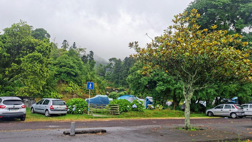

How I saved money

I stayed in a tent — and that was a joy of its own. The Azores are sparsely populated, and there aren’t many hotels, especially on the smaller islands. In high season, finding accommodation can be a real challenge. And prices — well, they’re sky-high, especially in summer. 


So camping turned out to be not only the most atmospheric option but also the most sensible one. Every island has campsites — some are free municipal ones, others cost a symbolic 7–12 €. For that, you even get hot water and decent facilities.


On the largest island, São Miguel, I traveled by car. Flores, about 17 by 12 km in size, I mostly explored on foot, though I occasionally called a taxi — not all trails form loops, and sometimes getting back wasn’t easy. To Corvo, a tiny island just 6.5 by 4 km, I arrived by boat and spent my time there walking.


And on Pico, where I stayed only two days, I rented a car again — otherwise, I wouldn’t have managed to see everything or climb the volcano, the highest point not only of the Azores but of all Portugal.


Getting to the Azores

The logistics of this trip turned out to be quite complicated.

To visit just four islands, I had to take eleven flights in total! 


On top of that, public transportation on the Azores is rather limited, especially on the smaller islands. For example, on Flores I had planned to return from my trekking routes to my campsite by bus.


But it turned out that buses there are almost mythical — they do exist on the schedule, but in reality, not always. They run only on weekdays, once or twice a day, and sometimes just never show up at all.


Luckily, there were taxis. They were expensive, but not insanely so. And a few times I was rescued by locals who kindly gave me a lift when they saw me standing by the road with my backpack. Those little moments of kindness I’ll never forget.


Flying Between the Islands

Inter-island flights are a story of their own.


The Azores are connected by a network of short domestic routes operated by SATA Air Açores. The planes are tiny, usually for 30–40 passengers, and they almost always run on time — weather permitting, of course.


Sometimes a flight lasts only half an hour, and it feels like you just take off to land again immediately. But the prices, unfortunately, aren’t as short — especially if you buy tickets at the last minute. I booked mine in advance, so it wasn’t too bad.


Each airport on the Azores is miniature — more like a bus station than an airport. But there’s a certain charm in that: no queues, no stress. Everything feels calm, homely, and unhurried — just like life on the islands themselves.


Costs and Routes

All this logistics didn’t come cheap. Flights from the mainland — from Porto — and between the islands cost me around €450 in total.


To Porto, I flew from Helsinki and back for €320 with airBaltic, connecting in Riga — with, as usual, terribly inconvenient arrival and departure times.


But, as so often happens in travel, all the inconveniences fade away once you finally find yourself in the place you’ve been dreaming of for so long.


Azores! This is where the Old World ends. Beyond this point it’s just the ocean… and the New World.


From the easternmost Azorean island to mainland Portugal it’s about 1,400 km — and from the westernmost one to the coast of Canada it’s almost 2,500 km!


The Azores! On a regular map you won’t even see them — nine tiny specks in the middle of the Atlantic. These islands rose from the ocean floor hundreds of thousands of years ago, born from powerful volcanic activity.


Until the 15th century they remained completely uninhabited, preserving their unique flora and fauna. Only in 1430, during the Age of Discovery, did bold Portuguese sailors stumble upon these lands — and by 1439 the colonization had already begun.

If you’re not in the mood to read everything in one go, just use the links below to jump straight to the island you’re interested in. I listed them in the exact order I visited them.

Island of São Miguel

São Miguel is the biggest and the most “alive” of all the Azorean islands.


Its area is about 750 km², stretching roughly 64 km in length and up to 16 km in width. Around 140,000 people live here, and its capital — Ponta Delgada — is where almost all flights land and where most travelers begin their Azores adventure.


The island is volcanic, and you can feel it everywhere: hot springs, thermal pools, steam rising straight from the ground, and endlessly green rolling hills. This is where you’ll find the famous Sete Cidades and Furnas lakes — and also the only tea plantations in all of Europe.


The climate is mild year-round: around +17 °C in winter and about +25 °C in summer. No wonder São Miguel is often called “the Green Island.”

I’m cruising around the island in a Fiat Panda — small, nimble, and already feeling like a loyal travel buddy. But before diving into the scenery, I had to solve the most critical mission of all: finding gas for my camping stove. I can survive without lunch… but without my morning coffee? Absolutely not.


Three hours of searching. Nothing. Not a single gas canister. Welcome to island life!


Eventually I gave up and left the city, heading to one of the campgrounds I had marked. It’s a municipal one, free of charge, offering the absolute basics: toilets with cold water, outdoor showers, washing sinks, no kitchen, but at least a grill outside. In short — kind of a mess. But oh, what a place!


Sete Cidades — Parque de Campismo das Sete Cidades (link) sits right on the shore of one of the island’s most beautiful calderas. Lakes, volcanic slopes, lush greenery — a postcard-worthy view. You forgive a lot when the scenery looks like that.


I had about three hours before sunset. Even with the low clouds, I went for a short hike. The clouds didn’t help the views, but it was still magical. I barely made it back before dark — and on the way I picked up two stranded French hikers whose phones had died and who had no flashlights.


This trail has plenty of climbs — nothing technically difficult, but your legs definitely get the memo. What turned out to be much harder was trudging through the bog. 


In some spots I was literally sinking into mud. With humidity pushing what feels like 100% and rain that comes and goes as it pleases, the whole squelchy mess turns into a real slip-and-slide — slick, sticky, and oh-so-Azorean.


The AllTrails version of this hike is about 13.5 km long with over 600 m of elevation gain. On the map it looks like an endless series of loops. You can basically park and start anywhere you find a spot. 


I managed only about 6.5 km — it was already evening, and the weather wasn’t exactly cheering me on. But even so, even though I spent most of the walk inside what felt like solid fog, the views that occasionally broke through were stunning: bright green hills and calm, blue water.


Both lakes sit at around 800 m above sea level, surrounded by forest, and are considered some of the island’s “quiet corners.” The trail takes you through cryptomeria forests and the grassy plateaus of a volcanic caldera, with beautiful views and that “wild nature” vibe. There’s also a climb up Pico das Égua (873 m), from where, in good weather, you get impressive views of the neighboring lagoons.


It was my very first day in the Azores. I hadn’t even seen the main highlights yet, but my heart was already skipping beats — even from the views peeking through the clouds for just a moment.


Sete Cidades is a huge crater, about 5 km across, formed by a series of massive volcanic eruptions around 36,000 years ago. Inside the caldera are two stunning lakes, connected by a narrow strip of land: Lagoa Azul (Blue Lake) and Lagoa Verde (Green Lake).


Their different shades come from variations in depth, reflections of the sky, and the surrounding vegetation, making them look like two completely different lakes from above.


The village of Sete Cidades sits right in the heart of this volcanic wonder. Tucked into the western side of the caldera, it’s home to around 700 people, with a church and a couple of restaurants — which, thanks to my no-frills campsite, is where I ended up grabbing my meals and morning coffee.

If you decide to hike only one trail on São Miguel, let it be the loop around the Sete Cidades caldera!


It’s a 20-kilometer route with about 800 m of elevation gain. Sunscreen and at least 3 liters of water are a must — and don’t forget snacks.


There’s only one village along the way. I started and ended my hike there, which meant that for the entire day there was nowhere to refill water or grab a bite.


This is a trail you simply can’t forget: for almost twenty kilometers you’re surrounded by breathtaking views — the lakes, the rolling green slopes, and the endless ocean. 


Don’t expect to move fast: every few steps you’ll find yourself stopping, turning around, and taking out your camera again. What makes the walk even more magical are the thick hedges of wild hydrangeas lining the road, giving the trail a fairy-tale feel.


The trail itself isn’t difficult — mostly dirt roads and gentle hills that stay easy to walk even when your legs are already tired from excitement.


On one side you have the calm surface of Lagoa Verde and Lagoa Azul, and on the other — the hazy outline of the Atlantic’s northern coast. But don’t count on steady views: the weather here changes instantly.


Sometimes everything disappears into thick fog and the whole caldera seems to vanish; five minutes later the sun breaks through, and the landscape explodes with color. There’s no need to rush. If a cloud rolls in — just wait. Missing those views would be a real shame.


There’s also an extended version of this route that combines the caldera loop with the trail I did the day before. In total it’s about 32 kilometers, and doing it in one day is pretty challenging.


Trail Circuito do Cum pequeno e Cum grande – link


I’d recommend setting aside at least two days for Sete Cidades — so you can enjoy the views without rushing and have some extra time in case the weather turns unpredictable. 


If the weather isn’t great, it’s better to wait a bit rather than hurry: you can simply drive to the east coast, where it’s usually sunny and clear — and it’s only about a 30-minute drive!


There you can enjoy the scenery, swim in the Atlantic, and even soak in natural thermal waters.


For example,Praia dos Mosteiros (link) is a beautiful beach with black volcanic sand and a calm, relaxed atmosphere. The rock formations create little lagoons where you can swim safely.


Or Ponta da Ferraria (link) — a unique blend of the ocean and hot springs. There are proper thermal pools, as well as spots right in the ocean where hot water mixes with the sea, turning it into a natural spa.


To be honest, I went there, took a look, but didn’t get in — I’m not much of a “soaking in the water” person, and the amount of people there scared me off a little.


After exploring the western part of the island, I headed east. My next stop was Furnas — a small town tucked inside the lush green bowl of the Furnas volcano’s caldera, which naturally comes with a bit of volcanic risk.


The area around Furnas is full of hot springs, bubbling mud pools, boiling-water cauldrons, and steaming fumaroles. All of these are signs of an active geothermal zone, even though the last eruption here happened back in 1630.


People come to Furnas for peace and quiet, for its thermal waters, and for the special atmosphere you only find in places where a volcano is still quietly breathing beneath your feet. The town has a population of just about 1,500 people.


I stayed at the local campground Parque de Campismo das Furnas. This time the campground wasn’t free, but for 7 euros you at least get a hot shower — totally worth it. Another big plus was its location: almost right in the center of town. All the main sights were within easy walking distance:


Caldeiras das Furnas (Furnas fumaroles) — a geothermal zone right in the center of town: boiling cauldrons, bubbling mud, clouds of steam, and that unmistakable sulfur smell. It’s one of the most atmospheric places here, especially in the evening when everything is lit by street lamps.


Terra Nostra Garden – A huge botanical garden filled with tropical trees, long alleys, and a large thermal pool with warm, iron-rich water. The entrance fee is 17 euros. And I’ll be honest: I paid, went in, dipped into that warm, smelly, murky iron-colored pool, strolled through the park… It is beautiful, but my wild trails were far more magical. 


So for me, those 17 euros felt pretty much wasted. But many people come here for a week and spend most of their time relaxing and soaking in the park, so — as they say — it’s all a matter of taste.


Poça da Dona Beija is another popular spot with thermal pools. Several small baths with fresh warm water surrounded by tropical greenery — perfect in the evening.


You can also try Cozido, the famous Furnas dish cooked using volcanic heat. Meat and vegetables are placed in a big pot and buried in the ground right next to the fumaroles, where they slowly stew for several hours. The result is a rich, tender, aromatic stew with a slight mineral note.


So those little “graves” with nameplates scattered around aren’t graves at all — they’re makeshift underground ovens. And the plates show the customer’s name and the pickup time. True geothermal cuisine!


My first hike in Furnas was the Pico do Ferro Trail — a short 6 km loop that starts at the fumaroles on the shore of Lake Furnas and leads up to one of the best viewpoints in the area. 


From the top of Pico do Ferro you get a full panoramic view of the entire caldera and the lake — a sight absolutely worth every minute of the climb.


In simple terms, it’s an ascent and descent through dense forest, fern thickets, and damp green ravines. Along the way you get occasional peeks at the fumaroles and hot springs — a constant reminder that a volcano is quietly breathing beneath your feet. 


Thanks to the lush ferns and moss-covered slopes, this area is even nicknamed the “Enchanted Forest.”


And honestly, in fog or in rays of sunlight filtering through the thick tropical canopy, the trail really does feel magical. It’s best to go in good weather though — in fog or low clouds the summit view may be limited, and the trail becomes slippery.


The climb here is pretty steep, after all.

When I climbed up to the viewpoint it was blazing hot, but by the time I started descending, clouds had rolled in and a light drizzle had begun. 


And since one trail clearly wasn’t enough for me — but I also wasn’t thrilled about scrambling around on slippery slopes — I picked a nice, “retirement-friendly” flat walk instead.


The Lagoa das Furnas & Salto do Rosal Trail (PRC 06 SMI) is a loop of about 9.8 km and takes roughly 2.5–3 hours.


The route takes you through the scenic areas around Lake Furnas, past volcanic zones with fumaroles and hot springs. Then the trail continues into the José do Canto forest garden, where a quiet little waterfall is tucked away.


The climbs are gentle, with a total elevation gain of about 280 meters. Parts of the path are paved, which makes the walk very comfortable. There’s a small entrance fee for the garden where the waterfall is located.


In short, it’s the perfect slow-paced walk to recover after the heroic, muscle-burning hikes of the previous days.


This was the only trail I didn’t manage to complete — and the video shows exactly why.


Lagoa do Fogo Trail is considered one of the most scenic hikes on São Miguel. It leads to a huge volcanic lake hidden inside a caldera. The round trip is about 11 km with around 500 m of elevation gain, so it’s rated as a moderate hike.


The trail starts through green hills, lava fields, and fern-filled forests. From the south coast, it gradually climbs toward the center of the island, and at times it really feels like you’re in Madeira! The path follows a “levada” — a narrow water channel with fish swimming in it, while massive ferns lean over the water.


Suddenly, the tropical forest gives way to rugged cryptomerias and pines — a sign you’re already at the edge of the caldera. From there, it’s just a short descent to the lake’s amphitheater, where normally you’re greeted with breathtaking views: clear blue water surrounded by wild green slopes.


But that day something went wrong. It started sunny and perfect, but while walking along the levada, I noticed the air thick with mist, sparkling with tiny rainbows. By the time I reached the high point of the trail, i realized why — a massive cloud was sitting right in the caldera, and I had to descend straight into it. 


At that moment, I knew I probably wouldn’t get to see the beautiful blue lake.

I still hoped the cloud would clear quickly — that often happens here. But not this time! The storm only grew stronger. At the lake shore, powerful gusts nearly blew me over, and sharp raindrops stung from all sides, like a natural jacuzzi.


I had no choice but to turn back the same way I came. Ironically, by the time I was heading back to the car in about an hour the sun was shining on me


Looking up one last time, I saw a massive black cloud looming over the caldera — the storm was just getting started up there. So close and such a big difference!


It was an amazing experience! But I wasn’t ready to give up on seeing Lagoa do Fogo (which literally means “Lake of Fire”), so I decided to try approaching it by car from the north side of the island instead of the south. 


Unfortunately, because of the storm, the road through the center was closed until the evening.


So I headed down to the beach and, for the first time in five days on this tropical island, took a dip in the ocean. Água D’Alto is a wonderful, almost deserted beach — highly recommended for anyone who loves swimming. 


I was happy with just half an hour in the water. While there, I found ways to pass the time until evening and even discovered another amazing trail nearby.


And finally, just before sunset, I got my reward: the long-awaited view of Lagoa do Fogo.


Rota da Água – Janela do Inferno is one of the most unusual and atmospheric trails on São Miguel. It’s not your classic mountain hike — it’s more like a journey along old water channels, tunnels, and aqueducts hidden in dense tropical greenery.


The trail is easy in terms of difficulty: a loop of about 7 km with minimal elevation gain. But it does have a sense of adventure — several dark tunnels you definitely don’t want to enter without a flashlight. And the tunnel height is only really comfortable for a ten-year-old. Luckily, I always carry my “flashlight-whistle-space blanket” kit!


The path follows an old irrigation system, sometimes literally carved into the rocks. It’s perfect for anyone who loves the atmosphere of abandoned engineering works and lush, damp green canyons.


The forest around is mossy and wet, filled with the sound of running water — the best place to feel the truly “wild” side of the Azores.

The highlight of the trail is Janela do Inferno, or the “Window of Hell”: a sheer basalt wall with thin streams of water trickling down from underground springs. Small openings in the rock are home to flocks of rare bats and birds — a mystical, almost hypnotic sight.


On the way back, the last couple of kilometers pass through fields and villages.

It was fun to watch cows being milked and to see local farmers battling the hydrangea bushes that keep breaking free and blocking the paths.

For us, hydrangeas are beautiful flowers,  postcard views, symbols of the Azores. For them, they’re a relentless weed, growing wherever they shouldn’t and faster than they can trim it.

On my last day on São Miguel, I finally decided to leave the wild forests behind and visit a proper, “civilized” attraction.


The tea plantations of São Miguel are one of the most unusual spots on the island — a true gift for nature lovers. Here, in the middle of the Atlantic, tea has been grown for almost two centuries, and São Miguel remains the only place in Europe producing tea on an industrial scale. 


When I first arrived, I just stood there in disbelief: “Wait, where am I? The Azores? Asia? Portugal or Sri Lanka?”


The plantations are located on the north coast. The largest ones are Porto Formoso and Gorreana, which I visited first thing in the morning. The slopes are gentle, green, and dotted with neat rows of tea bushes cascading toward the ocean. On a clear day, the landscape feels like a rare mix of Asia and Europe at the same time.


At Gorreana, everything is old-school: tea is still picked by hand, and you can walk inside for free to see how it’s processed on vintage machines — all working, humming, and smelling of fresh leaves. But that’s not all!   

You can also taste the tea for free! The tasting room is open to everyone. For visitors, several short trails run right through the tea rows, leading up to viewpoints. 


The routes are easy, scenic, and perfect for a foggy or rainy day when the mountain trails are closed — for example, theGreat tour through the tea plantations of Gorreana Factory (link)


They produce three types of tea here: green, black, and opa (large-leaf). It’s smooth, never bitter — the humid climate makes the leaves grow slowly and soak up all the flavors. 


In short, visiting the tea plantations isn’t just a tour, it’s a little teleportation: it feels like Europe under your feet, but tastes like pure Asia, with a view of the Atlantic thrown in for good measure.


That day I felt like exploring some of the quieter, more “cozy” trails. TM06 Moinho do Félix Trail is one of those charming, very easy hikes on São Miguel where instead of endless climbs, you get waterfalls, old mills, and babbling streams. The route is short — about 5 km.


The trail starts in the village of Lomba de São Pedro. At first, you walk along narrow country streets past houses with orange roofs, then the path drops down into a gorge where water mills once stood — hence the trail’s name.


Then comes the fun part. Cascata do Homem is the first waterfall — small but incredibly picturesque. Next, the trail passes old mill buildings, overgrown with moss and ferns, like something straight out of an elf movie. 


And the final highlight is Cascata da Gruta, a waterfall hidden inside a small stone grotto. It’s intimate, misty, and full of atmosphere.


The trail is fairly wet in places and can be slippery, but overall it’s easy. Along the way, there’s plenty of shade, lots of water, and endless greenery — perfect for a hot day or when you just want a calm, beautiful walk.


Next, I drove along the east coast and ended up on the south side of the island. The Salto do Prego Trail starts in the charming village of Faial da Terra, where time seems to have stopped: old stone houses, silence, and cats slowly crossing the streets like they actually own the place.


From the first steps, the trail dives into dense forest. Humid air, giant ferns, moss-covered rocks — pure tropical fairy tale. Sometimes you walk along a stream, sometimes up old stone staircases — everything feels authentic and cozy.

After about an hour to an hour and a half, you reach Salto do Prego, a powerful waterfall plunging into a deep emerald pool. It’s super cinematic: mist in the air, the roar of water, green all around. In summer, people swim here, but the water is so refreshing it wakes you up instantly, even after five hikes in a row.


If you’ve still got energy and a taste for adventure, you can continue to Salto do Carragão. This part of the trail is less popular, so there are hardly any people, and nature feels even wilder. Carragão isn’t as tall as Prego, but it’s more secluded and intimate — the perfect spot to sit, have a snack, and just listen to the water.


The final highlight of the trail is the abandoned village of Sanguinho. Old stone houses, overgrown paths, the feeling that people once lived here but left, and nature quickly reclaimed everything. 

The trail is moderate in difficulty: there are climbs, slippery sections, lots of stairs, but nothing extreme. The total distance is just under 8 km.


In short, Salto do Prego + Carragão is the perfect “combo trail”: waterfalls, a ghost village, jungle, the sound of rushing water, and maximum beauty packed into a couple of hours.


One of the surprises on this trail is a colony of wild chickens, who seem to have long decided the forest is their rightful kingdom. 

Some say they’re descendants of domestic birds that escaped or were released. Others are sure it’s a fully “wild” population, perfectly adapted to life among the ferns and mossy rocks, and thriving here.


They aren’t afraid of people at all, calmly crossing the trail, scratching in the forest floor, and posing like they know that a photo with a “wild rooster” will get as many likes as a waterfall. And these aren’t ordinary backyard chickens — these guys can fly. Not just hop up a bit like normal hens, but really soar onto high tree branches, where they sit and watch everything happening below.


Interestingly, they seem to have their own natural chicken social system: roughly equal numbers of roosters and hens — no usual “one rooster, harem of hens” setup. It’s like they invented their own perfect forest society. 

And yes — these feathered residents make the trail even more lively and atmospheric.


In the evening, I managed to take a little stroll around Ponta Delgada. It’s a cozy port town with black-and-white volcanic architecture, a lovely waterfront, plenty of cafés, a market with fresh fruit and fish, and the overall vibe of a calm southern town.


The main sights are the Portas da Cidade gates and São José church. narrow black-and-white streets, and palm trees along the ocean. And of course, the magical azulejos


Oh, how I love spotting them everywhere! I’m not usually a big fan of capitals (unless we’re talking Istanbul or Budapest :)), and Ponta Delgada felt a bit quieter than, say, Funchal. So I decided not to waste any time and rushed off to watch the sunset at Sete Cidades again. As they say, for a spirited horse, a hundred miles is no detour!


The next morning, I arrived at the airport two hours before my flight. Totally unnecessary — the airport is tiny, you could easily show up half an hour before departure.


Flores Island

If you only get to visit one Azorean island, make it Flores!


It’s the westernmost island of the archipelago. Its name, Flores, literally means “Flowers” — and for good reason: in summer, the island transforms into a giant garden of hydrangeas that grow along practically every road. 


Flores is quiet, peaceful, and almost entirely rural. About 3,500 people live here, but there are way more cows — the bovines clearly win the demographic race.


Flores is small, but incredibly rugged. In just ~140 km², you’ll find dozens of waterfalls, craters, lakes, and sheer cliffs. The airport is about the size of a medium supermarket: a short runway, a terminal that feels like a provincial bus station, and a baggage carousel that can barely fit a dozen backpacks.


The island has seven volcanic craters, each with its own lake: Caldeira Funda, Caldeira Rasa, Caldeira Lomba… a chain of tranquil turquoise bowls nestled in lush greenery. 


Atmospheric, unique, and absolutely mesmerizing!

Historically, Flores has been one of the most isolated places in Europe. Fun fact: the island sits on the North American tectonic plate


Locals joke, “We live in America, but with an EU passport.”

Accommodations on Flores are critically scarce, and hotel or guesthouse prices are out of this world. But there’s a real treat for tent travelers: four municipal campsites that are completely free!


With a bit of planning, you could explore almost the entire island in four days, camping at these sites. The main trail on Flores  GR01 — Grande Rota das Flores (FLO) is designed precisely for multi-day hikes.


I had originally planned to hike the island in a full loop. But at the time of my visit, the second stage (from the northern tip to the westernmost point) was officially closed. As it turned out later, it was perfectly passable, and I ended up doing it twice, in both directions, simply because the route worked out that way.


In the end, I took a different approach: I stayed four nights in one place Parque de Campismo da Fajã Grande , right at the edge of Europe — and did day trips from there. This turned out to be perfect: no packing up camp every day, and returning to the west coast in the evening was pure bliss. Sunset therapy at its finest.


The campsite has green lawns, flat tent pitches, toilets, showers (sometimes with a surprise water pressure — depends on your luck), sinks, and even a small covered cooking area.


The best part? Location. The ocean is literally 100 meters away. Plus, there are a few cafés nearby with very reasonable prices.


Oh, and if you need gas for cooking, Flores has you covered — you can buy cylinders of any type at Movipesca, just 500 meters from the airport.

You can find the bus schedule for Flores here. But trusting the bus system on Flores? Yeah… I wouldn’t.


First, buses only run on weekdays. Second, even if the schedule claims a bus will show up, that absolutely does not guarantee that it will!


On my very first day, I spent an hour waiting at the stop, gave up, waved at the universe in frustration, and left to walk back my 13 km on foot. The locals just shrugged and laughed when I showed them the “official” timetable.


As you can see from the chart, there are only 1–3 buses a day per route — and that’s on a good day. Car rentals start from 80 euros per day. But you always have to plan you day to come back to the car… Much cheaper to take a taxi once or even twice a day! So, there’s one simple rule on Flores: Taxis are your everything.


The price is fixed and surprisingly reasonable by island standards: 20 euros from anywhere to anywhere (as of summer 2025). 


Here’s a link to the list of taxi drivers. As you’ll notice, the entire island has exactly seven of them!


I had my own personal hero — John Coelho. Not only did he drop me off at the trailheads every single day, but on my last day he even gave me a mini sightseeing tour of the viewpoints I hadn’t managed to reach on foot. Free of charge, by the way — “for the road,” as he put it.


We even had dinner together a couple of times. People on Flores live pretty isolated lives, they don’t get much social interaction, so they’re always happy to chat with travelers. 


On my first day, I tackled trail PR02 FLO — Lajedo → Fajã Grande, but flipped it around and hiked from my camp in Fajã Grande to Lajedo instead. It’s an absolutely gorgeous route that hugs the wild west coast of Flores, and trust me, there’s not a single boring moment.


The beginning in Fajã Grande starts off gentle and almost deceivingly easy. The trail meanders through bright green pastures where cows look at you with that classic “ugh, tourists again” expression. But then? The real fun kicks in.


Poço da Ribeira do Ferreiro — this place literally steals your breath. Picture a massive green cliff wall with dozens of delicate waterfalls streaming down its face. 


Everything is lush, misty, and feels like you’ve wandered straight into the heart of some tropical fairytale. I took photos (of course), and while they turned out stunning, standing there in person was just unreal. Easily one of the most magical spots on Flores — the island’s ultimate calling card.


After that comes the drama: narrow cliff-side paths with the ocean roaring somewhere far below, waves smashing into black basalt walls, and wind so strong you’ll want to keep a death grip on your cap. Somewhere around the halfway point, a thoughtful local set up a tiny table with a thermos of cold herbal tea for tired hikers, with a little jar for donations if you feel like leaving one. So wholesome!


The scenery never stops. Cascading streams, mini-waterfalls, abandoned stone houses, flowers in every direction, and greenery so intense it’s like someone cranked the saturation slider to +200. But honestly, that’s just Flores being Flores.


The middle stretch is pure bliss: constant views of the chain of fajãs — those flat “terraces” wedged between the cliffs and the sea where fishermen used to live. Now they’re practically deserted. Just silence, ocean, and you.


As you approach Lajedo, the trail loops back inland through more pastures, and suddenly it feels like you’ve walked through a time portal: a couple of old stone mills, farmers zipping by on quad bikes, and flowers absolutely everywhere.


The finish line is the sleepy little village of Lajedo, where life moves at the speed of a very drowsy turtle — which is exactly the vibe you want after a hike like that. The trail itself is moderate difficulty, and the views? Postcard-level perfection. 


I ended up logging 16 km total because I also walked to the bus stop… and then kept walking back until my savior (a.k.a. my taxi-John) finally showed up. Otherwise, I would’ve stumbled into my tent well after dark!


PR03 FLO — Miradouro das Lagoas – Poço do Bacalhau is pure magic for anyone who loves greenery, water, and wild nature.


The trail kicks off at Miradouro das Lagoas, where the viewpoint opens up to a stunning sight: two volcanic lakes, Lagoa Funda and Lagoa Rasa, nestled deep in a lush green caldera. 


Right away, you realize that Flores is a place where nature knows how to put on a show. What really strikes you is the contrast between the two lakes.


They sit right next to each other, but they look like two completely different worlds.


Lagoa Funda — the water is dark green, almost like bottle glass, as if it’s reflecting all the forest depth surrounding it. This one’s deep, around 30 meters.


Lagoa Rasa — the water is bright blue, practically glowing in the sunlight. It shimmers and reflects the sky like it was painted by an artist’s brush. Much shallower here, only about 15 meters deep.


Fair warning: it’s very wet up top, and the trail cuts through some legit bogs in places. Sometimes you’re walking along and suddenly you’re ankle-deep in mud — but hey, that’s all part of the adventure! 


Then you emerge at a dramatic cliff edge, and suddenly, through tangles of hydrangeas, the view opens up to the western coastline stretching for kilometers. Absolutely breathtaking!


The descent to the ocean is no joke either: rocks are slippery, and you’ll find yourself grabbing onto anything you can to stay upright.


And the finale? Poço do Bacalhau. A waterfall plunges into a deep pool, the water is crystal-clear blue, and everything around you is pure green silence.


The route isn’t easy, but the payoff is absolutely worth it. Perfect for anyone who loves wet adventures and nature’s dramatic beauty. The official track is 7 km, but I ended up clocking over 10 — kept wandering off-trail hunting for even more jaw-dropping views.


I hiked this trail in reverse — from Ponta Delgada to Fajã Grande. My trusty “knight” John the taxi driver dropped me off at the trailhead.


Officially, the trail has been closed for several years now, but in practice, everyone still hikes it, and I didn’t see anything scary about it. I mean, unless you’re afraid of walking along a narrow path above a 200+ meter drop — then yeah, it might seem a bit intense. But my fear of heights completely vanished at some point in life, so I walked along calmly.


It turned out to be the sunniest and hottest day of my entire time on Flores, so I got slightly less enjoyment out of it than on previous days — a little nerve-testing is always useful, though. 


For me, it was pure bliss: fresh air, adrenaline, and that feeling of walking along the edge of the world. PR01 is definitely worth doing, especially if you’re into a bit of an adrenaline rush.


In places, the trail was seriously overgrown — I had to push through two-meter-high thickets. There were sections with pretty steep rocky descents and climbs, but on a dry, sunny day they’re completely safe.


As I was already descending toward my campsite, I realized that PR01 had flown by way too fast — I wanted more adventure! I frantically started googling for interesting nearby trails and stumbled upon Cascata de José Fraga


Now that’s a spot where you definitely won’t run into anyone else!


And it was a real adventure. The waterfall is stunning, but there’s barely a trail to speak of: I had to bushwhack my way through, navigating by the sound of falling water. 


This is where your inner explorer truly kicks in — tropical jungle vibes, narrow passages, roots, bushes, rocks, humidity, and wild greenery everywhere.


In the video, you can see the “toughest” moments of the day — the narrow trail along the cliff edge and pushing through the nearly impenetrable forest. In the end, it was a perfect mix of adrenaline and pure aesthetic bliss!


That day I covered 15 km.


Right before my flight out of Flores, I got a little island tour — all the spots I didn’t manage to visit on my own. And even on a cloudy day, the views were stunning. Honestly, this island throws beauty at you every few steps.


Just imagine: the island is tiny — only 17 km long and 12 km wide — yet the amount of scenery packed into it is insane. An unbelievable concentration of beauty per square kilometer. 


The landscape changes every few hundred meters: green slopes, sharp cliffs, mini-waterfalls, mossy meadows, lakes inside a caldera… all of it squeezed into one tiny piece of the Atlantic.


Flores is my favorite place on this planet!

Corvo Island

I didn’t plan to visit Corvo at all. It wasn’t even on my radar. But my taxi driver on Flores talked about it with such enthusiasm that he practically convinced me it was a must-see. And he was right!

So… Corvo!


A tiny volcanic island of just 17 km². Basically, the whole island is the top of an ancient volcano, and its heart is the spectacular Caldeirão — a massive caldera about 2 km across and roughly 300 meters deep.


There’s only one settlement here — Vila do Corvo. And only one road: it climbs up from the village, where the pier and the baby-sized airport are, straight to the rim of the caldera. From the viewpoint at the top, you can see the entire island laid out like a model.


You can get here either by a speedboat from Flores or by plane. And this is probably the smallest airport I’ve ever seen. The runway is only 800 meters, so the only planes that can land here are tiny Bombardier Dash 8-Q200s with 37 seats. 


Arriving on Corvo feels like a mini-adventure of its own: the plane barely kisses the ground, and all around you is just ocean and this little green volcanic tip.


The population? About 430 people! There’s one school with 48 students — which sounds tiny, but that’s over 10% of the entire island. And somehow there are 22 teachers. The kindergarten has another 15 kids. And cows? There are roughly three times more cows than humans. Gotta love Azorean statistics.


Corvo is truly a unique place — a miniature world where everyone knows everything about everyone. A big family, island-style!


I didn’t fly to the island, of course. I got there from Flores by boat — they use open rigid inflatable boats that hold 12–15 people. 


On ocean waves, a boat like this really gets tossed around, then slams back down hard onto the water, drenching everyone in spray, and this goes on for nearly the entire hour-long journey! It’s not an attraction for the faint of heart, but the experience is intense.


And the whole way there, you’re accompanied by Cory’s shearwaters, unique birds and true sailors of the sea. They even fly underwater!


You get about 5 hours to explore Corvo, and then it’s time for the return trip.


The cost of the journey is €35, and it includes a mini-tour along Flores’ incredible eastern coastline: towering jagged cliffs and waterfalls plunging straight into the ocean. Seriously beautiful and seriously unique.


At the dock on Corvo, minibuses are already waiting to take visitors straight up to the crater rim. Technically, you can hike up on foot, but that’s 7 km of constant uphill climbing. 


Honestly — I’d recommend not skimping on the €10 round-trip transfer and spending that time gazing at the caldera views and just soaking in the island’s silence instead.


By the way, even here there’s a free municipal campsite! I’ve marked it on the map. There’s also a café with a buffet where you can stuff yourself for €14 — it only opens when the boats from Flores arrive.


Now for the main adventure on Corvo. There’s a famous trail here called PRC2 COR — Volta ao Caldeirão, and if you’ve made it to this island, you absolutely have to hike it. 

It starts at a viewpoint on the edge of a huge caldera — the same one you see on practically every postcard of Corvo. 


Picture this: you’re standing at the top of an ancient volcano, and below you is a giant bowl about two kilometers across, covered in moss, lakes, and green hills. And the colors! 


Emerald green and moss ranging from yellow to lime! And hydrangeas! And in all this beauty, hundreds of cows are grazing. They’re so fat and lazy that they even chew grass while lying down, and calves nurse from their mothers who are also lying down.


The trail first leads down into the caldera. The descent is pretty steep but safe — just make sure your shoes have good grip because the ground is damp in places. 

When you reach the bottom, it feels like you’ve entered another world: almost total silence around you, just wind and some birds.

In front of you are two lakes, marshes, and soft peat mounds that bounce like springs when you walk on them.


The route goes in a circle around the lagoons. Sometimes the trail gets closer to the water, sometimes it climbs small hills where you get beautiful views of the entire inside of the crater. 

You’ll occasionally see cows and horses grazing right in the caldera — they live here in complete freedom and total zen.


When the loop completes, you reach a big landmark rock and head back up the same trail. The climb is a bit more work than going down, but with every step the view of the crater opens up wider. It’s one of those moments where even silence feels good: you just walk and soak in the joy of where you are.

The whole trail takes about 2–2.5 hours, but you can go slower — the place is worth it.


In the end, it’s a small, peaceful, and very beautiful adventure. Nothing extreme, but incredibly atmospheric. You’re walking through a real volcano, looking at lakes inside a crater, listening to the kind of silence you only get on these tiny islands. 

And at some point you realize: this is exactly why it was worth coming to Corvo, getting soaked in the boat, bouncing over waves, and taking ocean spray to the face.


Pico Island

My first impression of the island… it doesn’t have that usual Azorean beauty. No hydrangeas, no lush greenery. This seems to be one of the youngest islands — it was still erupting in the 18th century.

The soil is black, the vegetation sparse.


The island, though the second largest in the archipelago, isn’t huge — only 42 kilometers long and 15 wide, but you feel its character immediately. Today about 14,000 people live here, and every village feels like an oasis of calm surrounded by volcanic power.

Mount Pico rises to 2,351 meters, and the clouds seem almost shy to touch it. Pico, by the way, is the highest point in all of Portugal.


For centuries, Pico lived to the rhythm of the sea. Whaling was practiced here from the 17th century and became a real profession. Men would go out for months into the Atlantic, armed with harpoons, and every successful hunt was an event for the entire village. 

In the 1980s, whaling was banned. The population dropped by almost two-thirds! Many families looked for new paths — moving to the mainland or migrating to America, while those who stayed turned to fishing and crafts. 

Today their legacy lives on in whale watching: former hunters now take tourists out and tell stories about the giants of the ocean.


Against the black lava soil, vineyards clearly stand out, protected by low basalt walls called currais. These vineyards are UNESCO World Heritage listed and create a unique landscape. 

 Wine from Pico is strong and rich, as if it absorbed all the power of the volcano, and winemaking became the island’s lifeline after whaling ended. Remember the name of the local wine: Verdelho.

Pico was not on my must-visit list. At first, I was considering other islands — more scenic, more postcard-pretty. But the trip needed at least one heroic climb. And where else, if not Pico — the highest point in Portugal?


Knowing how capricious the local weather can be, I immediately planned two full days (three nights) and rented a car. It’s an expensive pleasure here — 100 euros per day! Still, it allowed me to see something, even though for the first time on this trip the weather was not on my side.


There are only two campsites on the island, both marked on the map.
I stayed at Parque de Campismo Municipal da Furna, in the town of Santo António in the north of the island.

This was my most expensive campsite in the Azores — 12 euros per night. But in return I got hot water, a kitchen with a stove, fridge and microwave. And most importantly — a natural beach and a swimming pool right on the shore!


The campsite itself is spacious, built on several levels, very green, with an impressive number of power sockets everywhere. The nights were very warm — +22°C!  For me, this is almost unbearable. I had to sleep without clothes, with the tent wide open.


And an important note: there are no mosquitoes on the Azores.
No blood-sucking creatures at all! Now tell me — isn’t this paradise

Climbing Pico is a whole separate story. It’s the main reason I came to the island. But the mountain decided to show me its character right from the start. 


On Pico, everything depends on the weather: you can arrive in sunshine, and five minutes later find yourself in thick fog where visibility is maybe five feet and all you can hear is your own wheezing breath. 


I climbed under blazing sun, but everything below 1000 meters was buried in a thick sea of clouds. So all those views stretching for dozens of kilometers around, to neighboring islands and the chain of craters along Pico island — I didn’t see any of it. But at least I didn’t get soaked in rain or slip on mud!


I’ve climbed higher peaks before. Like Teide on Tenerife — almost 3,700 meters. And Pico is only 2,350. But the higher I went, the clearer it became: altitude isn’t everything. Much more important is the slope, the loose volcanic rock, and the technical difficulty of the trail itself. Honestly, the 20-kilometer climb up Teide was easier than these seven kilometers of volcanic hell!


You need to book your Pico ascent in advance here (link) — 2-3 months ahead for a specific date and time. The permit costs €25, and if you go with a guide it’s €80 and up. There are night climbs, sunrise climbs, even overnight stays in the crater, but all of that is strictly with a group and at completely different prices. The trail starts at Casa da Montanha. 


At the start they check your gear: no hiking boots — you’re turned around. Pants, rain jacket, minimum 1.5 liters of water — all must-haves. And naturally, a whistle! Plus they give you a GPS tracker so they can see you on the slope in real time. If anything goes wrong, they know which rock to evacuate you from. 


And before you start, you sign a paper saying you’ll owe €3,000 if you decide to go without a guide and something goes wrong. A pleasant little detail before the climb 😅


The climb itself didn’t seem too hard to me — after all, years of traveling and mountains do pay off. When you finally reach the Cratera — the volcano’s crater — you just want to collapse and hug that stone wall. But that’s not the end yet. 


The real summit is Piquinho, a little cone inside the big crater, and here some climbing experience comes in handy. 


And when you finally scramble to the top, feel the warm volcanic air rising from the cracks (yes, it’s actually warm — fumaroles, just like in Furnas!), look out at the endless sea of clouds, you realize it was worth even crawling for this. It feels like you’re standing on the edge of the world, and beneath your feet is a living volcano in an ocean of clouds.


But going down… going down took me longer than going up. Up — 2.5 hours. Back down — 3.5, and I was still passing people by the dozens. The slope in places is so steep that you can only move facing the mountain — you can’t place your foot forward or to the side. 


Somewhere around halfway down, the psychological torture begins: your legs are shaking, your knees feel like they’re filled with broken glass, your toenails are battered, the sun is beating down like you’re on Mars, and every meter down feels like a hundred.


And in that moment you wonder why, exactly, you do this voluntarily.


I always hike with one trekking pole — the second one died on Madeira — but this was the first time I desperately wished for two. The trail in good weather isn’t dangerous — just incredibly exhausting. 


And when at the finish they handed me a certificate for conquering Pico — I was as happy as if I’d just gotten a university diploma!


My second day on Pico wasn’t just cloudy — it felt like someone had poured milk into the air. The world around me dissolved, horizons vanished, and I felt like I was walking inside a giant white cotton pillow. 


I couldn’t do a single trail, but I had a car, and I decided to squeeze every bit out of it. In the end, on this tiny island I racked up almost 400 kilometers — yes, on an island the size of “two sneezes” that sounds like an achievement.


Sometimes the sun did break through the milky haze, and in those rare moments the island literally blazed — green, black, ocean blue. I managed to catch some stunning shots, the kind where even I can’t believe I took them on that particular day.


I’m sure there’s plenty to see on Pico. I just got unlucky with the weather this time.


If you have better luck — definitely let me know. I’m really curious about what I missed!

Porto

My long layover in Porto was no accident! In my personal ranking of European cities, Porto is consistently in my top three — alongside Budapest and Istanbul. 


And of course, I couldn’t pass up the chance to breathe in its atmosphere one more time, even though I only had a couple of free hours before sunset. 


Yes, there are fancy neighborhoods here with grand churches and magnificent buildings, but my heart has long belonged to Ribeira and Miragaia — the districts along the Douro River waterfront. 


Narrow cobblestone streets, colorful multi-story houses decorated with azulejos, balconies with laundry hanging out to dry — all of it creates the feeling that the city is living its life right in front of you. 


Houses here climb up steep slopes, clinging to every meter, and many of them — dating from the 16th–19th centuries, with wooden beams, creaky floors, and history — are still lived in today.


That simplicity and atmosphere is exactly why I love Porto.


In the last photo — my favorite church, oh, those azulejos! You can stand there, stare, and find a new scene every time.

And the city’s calling card — São Bento train station — is in the video.


 They bring tour groups here like it’s a museum, and for good reason — the walls are painted with true azulejo masterpieces.


And one more thing I love about Porto (and Lisbon too): you can get from the airport to the center in half an hour by metro, and for just €2.50! Walk out of the terminal — and you’re already in the city. 


If only it were like this everywhere!

You can leave your comments on this story in my blog 

sign up for the newsletter

Fill this form if you want to be informed 

about the new publications in my blog.

Spread the love